a downhill then uphill hike on the way back, 6 miles total with another 1 mile optional
WHERE: Circle X ranch, in the western Santa Monica Mountains
TRAILS MAP: https://www.nps.gov/samo/planyourvisit/upload/CircleX_1_fin.pdf
DRIVING TIME: Typically it takes an hour and a half from downtown or west L.A to get here.
PARK HERE:

HIKE HERE:

above: THE WEEPING HILLSIDE

(above: THE GROTTO)

(ABOVE: THE FALLS BELOW THE GROTTO)

(THE WEIRD TWISTED OAK TREE EVEN FARTHER BELOW THE GROTTO)

ABOVE: CUTE WILDLIFE
THE PLAN:
We will first past a series of cascading mini falls. Then we will connect with the Grotto trail and turn left, and cross a much bigger waterfall. Soon, to our left,we will see falls #2 and 3. Then when we hit the canyon bottom and an old campground, we are really close to the grotto. WE WILL MUNCH OUR LUNCH ON THE ROCKS.
The Grotto is really cool because this is a 20 foot underground waterfall, located in a room under a giant boulder in the canyon. On the way we may pass nice smelling wildflowers, if the lilac flowers are blooming yet.
THE OPTIONAL PART:
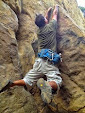
I WILL TAKE ADVENTURERS DOWN THE CANYON FARTHER, ADDING ANOTHER MILE TO THE HIKE. THERE ARE MORE WATERFALLS ALONG THE WAY. THIS PART OF THE HIKE IS CLIMBING ON ROCKS, WHICH IS NOT FOR EVERYONE. THERE IS A RISK OF THE USUAL SLIPS AND FALLS AND POISON OAK. SO IF YOU CHOOSE NOT TO DO THIS, WAIT AT THE LUNCH SPOT FOR ABOUT AN HOUR WHILE I LEAD THIS PART OF THE HIKE. THE SCENERY IS AMAZING WHETHER YOU COME WITH ME OR LOUNGE AROUND AT THE LUNCH SPOT. IF YOU WISH TO TURN BACK, THE TRAIL IS WELL MARKED WITH SIGNS WHICH I WILL POINT OUT ON THE WAY DOWN.
-----------------------------
HOW LONG IS THE HIKE: About 4 miles each way. This is an upside down hike, we go down past 4 waterfalls, then come back up. The last tenth of a mile of the hike requires some climbing over boulders to get to the last waterfall (the grotto--which is the underground waterfall in the picture above)
ELEVATION LOSS AND GAIN: We will descend 800 feet to the grotto in around 4 miles. Then take the elevator back to the top. Only the last tenth of a mile at the last waterfall requires some climbing over large bouders.
WEATHER: expected to be sunny
WHERE TO PARK?: There are 4 dirt parking lots at Circle X ranch. However, we will meet at the Sandstone Peak trailhead (see map)

PLEASE PRINT OUT THIS PRINTABLE VERSION OF THE MAP SHOWING WHERE TO PARK:
http://photos1.meetup...
SPECIAL PARKING RULES DICTATED BY THE NATIONAL PARK SERVICE:
BECAUSE THIS HIKE GETS REALLY POPULAR IN WATERFALL SEASON, WE ARE LIMITED TO 50 HIKERS MAXIMUM, AND CAR-POOLING IS MANDATORY--THE RANGERS GET A BIT CRANKY IF WE PACK THEIR PARKING LOT. WE ARE LIMITED TO 12 CARS.
CARPOOLING IS MANDATORY--A GOOD SPOT TO MEET FOR CARPOOLING IS ON PCH ACROSS FROM NEPTUNE'S NET (AT YERBA BUEBA ROAD). THEN DRIVE UP THE HILL 5 MILES TO THE PARKING LOT. Park in the lot with the sign saying "Sandstone Peak trailhead".
IF SANDSTONE PEAK LOT IS FULL, PLEASE DRIVE EAST 1/2 MILE TO THE TWO DIRT LOTS ON EITHER SIDE OF THE ROAD AND THEN WALK BACK TO OUR MEETUP SPOT
REMEMBER, THE DRIVING TIME: Typically it takes an hour and a half from downtown or west L.A to get here.
ALSO, HERE'S A PRINTABLE GOOGLE MAP: click on link http://photos1.meetup...

(NOTE: THE BLUE DOTS FOLLOW THE ROUTE WITH THE LEAST HAIRPIN TURNS--FOR THOSE THAT GET DIZZY EASILY)
--BRING A HAT!!!! BRING 2 OR 3 QUARTS OF WATER PER PERSON. STAY HYDRATED!. Also, you might get wet crossing the stream. We're in no rush, so let's be careful!
BRING: A HAT, SUNSCREEN, COMFORTABLE SHOES WHICH YOU DON'T MIND GETTING WET, AND FOOD---THIS IS NOT TOO HARD OF A HIKE!
-----------------------
PHOTOS OF THE HIKE AFTER THE LAST WEEK LONG STORM: FROM DECEMBER 27, 2010: http://www.meetup.com/hiking-196/photos/all_photos/?photoAlbumId=1200522
http://picasaweb.goog...
-----------------------
HOW TO GET THERE:
FROM THE WESTSIDE, take the 10 freeway to Pacific Coast Highway, go west past Malibu to Yerba Buena Road. Turn right, go up the hill 5 miles to the Circle X ranch ranger station, and about a half mile past that is the Sandstone Peak trailhead.
IF YOU CHOOSE TO TAKE THE 101 FREEWAY: take the 101 Freeway west to Kanan Dume Road in the city of Agoura Hills. Take it to the south, towards the beach. In about 5 miles, you will come to Mulholland Highway, Turn right, going west. In about a mile, the road forks. Take the left fork onto Encinal Canyon Road. Follow this for about 2 miles. It will run into Decker road (also called Lechuza or Highway 23). Turn Right. This will lead very shortly again to Mulholland. Turn left (west). A short distance ahead is an abrupt right turn called Little Sycamore Rd. (The name soon changes to Yerba Buena Road--don't worry !). Take this twisty road for another 2 miles and you will see the parking area for the Mishe Mokwa trail, go another half a mile and park at the Sandstone Peak trailhead --YES--PARK THERE!. (If you continue west on this road for another 1/2 mile, you will see the ranger station--we are not starting from here, however, there are restrooms and drinking water here)
No comments:
Post a Comment